Current Affairs
Cloudburst in Uttarakhand: Understanding its Causes and Consequences
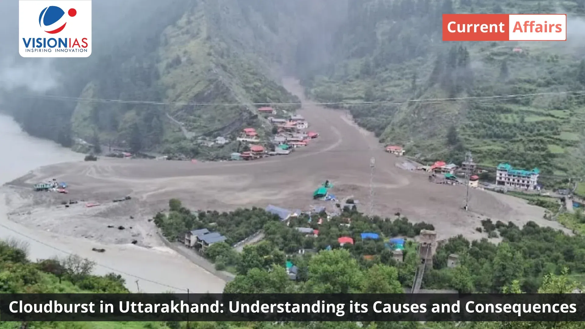


The cloudburst and flash floods in Uttarkashi district represent a critical juncture in understanding natural hazards in the Indian Himalayas.
The cloudburst in Uttarakhand on August 5, 2025, in Uttarkashi’s Dharali and Sukhi Top areas serves as a reminder of the Himalayan region’s vulnerability to extreme weather events. This incident highlights the interplay between natural hazards and human activities in one of India’s most fragile regions.
Understanding the Uttarkashi Disaster
The Uttarkashi cloudburst event began around 1:30 PM on August 5, 2025, which resulted in the Kheer Ganga river overflowing with force. The river, carrying amounts of silt and debris, entered Dharali town and caused destruction. Initial reports suggested multiple cloudbursts, with a second event occurring at Sukhi Top.
Scientific analysis has revealed a complex picture. Despite reports of cloudbursts, the India Meteorological Department recorded minimal rainfall in the affected areas. Harsil received only 6.5mm of rain on the disaster day, while Bhatwari recorded 11mm over 24 hours. These figures fall below the technical definition of a cloudburst, which requires rainfall exceeding 100mm per hour over a localized area.
This discrepancy has led experts to suggest that a Glacial Lake Outburst Flood (GLOF) or glacier collapse, rather than a cloudburst, may have been the trigger for the flash floods that devastated the region. Climate change is accelerating glacier retreat, leading to the formation and expansion of potentially dangerous glacial lakes.
Science Behind Cloudbursts and GLOFs
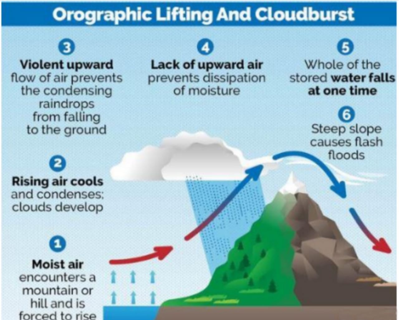
The cause of cloudburst lies in atmospheric conditions. Cloudbursts occur when warm, moist air from low-lying areas is pushed upward along mountain slopes through orographic lifting. As this air rises to higher altitudes with lower atmospheric pressure, it expands and cools adiabatically.
When the air reaches its dew point, water vapor condenses into droplets, forming cumulonimbus clouds. Strong updrafts within these clouds suspend water droplets and ice particles, preventing them from falling. The cloud becomes saturated and heavy until the updrafts weaken or droplets become too large, causing a sudden downpour. The shower is further intensified by a process called Langmuir precipitation, in which large raindrops collide with and absorb smaller ones as they fall, causing them to grow rapidly.
The GLOF alternative explanation offers a different perspective on the Uttarkashi disaster. The sudden release of water from glacial formations could explain the high-energy flash floods observed, particularly given the minimal recorded rainfall during the event.
This phenomenon occurs when glacial lakes, formed by melting glaciers, suddenly breach their natural dams and release large volumes of water downstream. The Uttarkashi event draws parallels to the 2021 Raini disaster in Chamoli, which was caused by a rock-ice avalanche that triggered floods, devastating hydropower projects and resulting in over 200 fatalities.
Impact Assessment
The disaster in Uttarkashi was devastating. The news reported widespread destruction, with multiple fatalities and many people missing. Several Indian Army personnel from a camp in the lower Harsil region were also among those affected.
Rescue operations involved a large number of personnel from various agencies, including the Indian Army’s Ibex brigade, the National Disaster Response Force (NDRF), the State Disaster Response Force (SDRF), and the Indo-Tibetan Border Police (ITBP). In challenging conditions, rescue teams are working to evacuate people to safety.
The disaster’s impact extended beyond human casualties. The village of Dharali was completely destroyed, and the market area was either submerged or washed away. The preliminary assessments indicated a significant loss of houses, hotels, and homestays.
Numerous roads across the state, including national highways, were damaged. The ancient Kalp Kedar temple was also destroyed. The implications for Uttarakhand’s tourism sector are severe, threatening to impact the regional economy, which relies on the Char Dham pilgrimage route.
Causes of Cloudburst in Himalayas
The frequency and intensity of extreme weather events in the Himalayas are linked to climate change. Scientists warn that the region is experiencing glacial melting, altering river flows and increasing the likelihood of GLOFs and flash floods.
Global warming has been connected to frequent and intense cloudbursts. The paradox is clear: while glacier melt increases water volume temporarily, it will lead to long-term water scarcity as glaciers shrink, triggering future crises.
Human activities have amplified disaster risks in the Himalayas. Unregulated development includes construction on unstable slopes and flood-prone riverbanks, settlements without geological assessment, and infrastructure projects like the Char Dham road widening that destabilize terrain.
Environmental degradation involves hill-cutting and deforestation removing natural buffers, poor drainage systems and riverbed encroachments, and illegal mining activities weakening geological stability.
The concentration of pilgrimage sites and tourism infrastructure in geologically unstable areas creates a combination where cultural and economic drivers place populations in high-risk zones.
Early Warning Systems and Response Challenges
Cloudbursts are difficult to forecast because they occur over a very small area. Forecasts for a very small area are difficult to predict. However, using Doppler radars it is possible to forecast the possibility of cloudbursts about six hours and sometimes 12-14 hours in advance.
Despite the India Meteorological Department issuing weather alerts, the disaster exposed gaps in early warning systems. The challenge lies not just in predicting events but ensuring warnings translate into community-level responses.
The government response was coordinated but faced limitations. The state government implemented measures including review meetings, 24-hour alert mode for district administration, ambulance services, helpline numbers, temporary shelters in hotels and schools, and food packet airdrops in cut-off areas. However, the scale of destruction indicated gaps between warning dissemination and effective action at the community level.
Building Resilience for the Future
Future resilience requires changes in development approaches. National Disaster Management Plan, 2019, provides for Cloudburst Disaster Risk Reduction (DRR) strategy.
- Terrain-specific hazard zoning and land-use policies need implementation.
- Mapping landslide-prone areas and identification of unsafe sites for human settlements
- Development planning must integrate ecological carrying capacity.
- GLOF studies should be mandatory for infrastructure projects in glacial catchments.
- Construction standards need to focus on disaster resilience, as highlighted in the NDMA’s guidelines which emphasize the importance of hazard-resistant design and building materials.
- Effective coordination and seamless communication among central and state agencies to ensure quick, clear, effective dissemination of warnings, information and data
- Nature-based solutions and ecological restoration provide sustainable alternatives.
- Drainage and flood management systems require improvement to handle extreme events.
Local disaster response training programs can build community capacity. Sustainable livelihood alternatives can reduce tourism dependence. Community-based early warning systems provide local solutions.
The rehabilitation efforts must focus not just on rebuilding infrastructure but on creating resilient communities that can adapt to changing environmental conditions.
Lessons from Past Disasters
The Uttarkashi disaster follows a pattern of similar events in Uttarakhand’s history. The 2013 Kedarnath floods, 2021 Chamoli disaster, and numerous landslides across the state demonstrate the region’s vulnerability. Each event has provided lessons about the need for better preparedness, resilient infrastructure, and sustainable development practices.
The Uttarakhand Disaster Recovery Project, supported by the World Bank, has financed reconstruction of over 2,300 homes, more than 1,500 km of roads, 26 public buildings, and over 80 bridges, ensuring new infrastructure can withstand future disasters.
Non-governmental organizations play a role in rehabilitation. Organizations have been involved in constructing bridges and solar installations, repairing damaged structures, and conducting skills training workshops including organic farming, youth leadership, trauma relief, and vocational training to empower villages towards self-reliance. These efforts focus on local participation and capacity building, which are essential for long-term community resilience.
Conclusion
The 2025 cloudburst in Uttarakhand serves as a call for disaster risk reduction in the Himalayas. Whether triggered by meteorological events or glacial processes, the message remains clear: the region requires transformation from reactive response to proactive resilience building.
Success will depend on integrating understanding with sustainable development practices, early warning systems, and community-centered adaptation strategies. Only through such approaches can we protect the Himalayan communities while preserving this ecosystem for future generations.
The Uttarkashi disaster reminds us that in our interconnected world, building resilience against natural hazards is not just a local necessity but a global imperative for sustainable development. The focus must shift from merely responding to disasters to preventing and mitigating their impacts through better planning, technology, and community engagement.

Master Digital Age Governance & Technology Trends with VisionIAS Comprehensive Current Affairs →
Visit the Mains Corner and elevate your UPSC Mains 2025 preparation.
Uttarakhand Cloudburst FAQs
1. What causes cloudbursts in the Himalayas?
Ans. Orographic lifting pushes warm moist air upward, creating sudden intense rainfall.
2. How do cloudbursts differ from glacial lake outburst floods?
Ans. Cloudbursts involve atmospheric rainfall while GLOFs release stored glacial water suddenly.
3. Why are Himalayan regions more vulnerable to extreme weather events?
Ans. Climate change accelerates glacial melting and increases atmospheric instability.
4. What human activities increase cloudburst disaster risks in mountains?
Ans. Unregulated construction, deforestation, and infrastructure projects on unstable slopes.
5. How can communities prepare for sudden flood events in hilly areas?
Ans. Early warning systems, evacuation plans, and disaster response training.