
Mozambique (Capital: Maputo)
Import of Tur dal by India resumed from the Nacala Port in Mozambique post disruption.
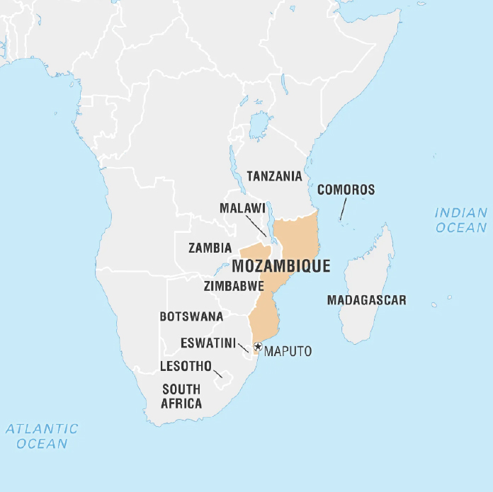
Political Features
- Location: South-east African country with a long coastline bordering the Indian Ocean.
- Mozambique Channel separates it from the island of Madagascar.
- Bordering Countries: Tanzania (North), Malawi & Zambia (North West), Zimbabwe (West), South Africa and Eswatini (South West)
Geographical Features
- Major rivers: Zambezi (largest) and Limpopo (both empty into Indian ocean), Ruvuma etc.
- Highest Peak: Mount Binga (part of the Chimoio highlands)
- Resources: Gold, emeralds, copper, iron ore and bauxite.

