
Recently, India’s External Affairs Minister raised concerns over the recurring arrests of Indian fishermen with the Sri Lankan President.
Background of the Maritime Dispute
- It relates to fishing rights in the Palk Bay region and stems from violations of the International Maritime Boundary Line (IMBL) and illegal fishing activities in the region.
- The Palk Bay, is a narrow sea strip separating Tamil Nadu and northern Sri Lanka rich in marine resources.
Maritime Boundary Agreements of 1974 and 1976
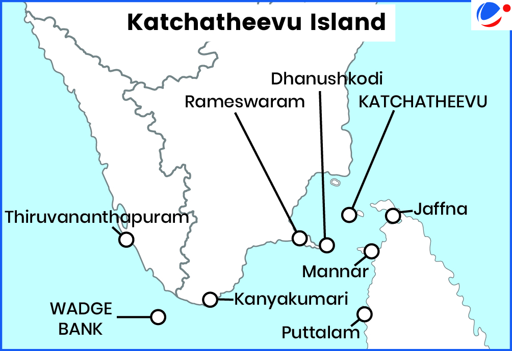
- 1974 Agreement:
- Island of Katchatheevu lies on the Sri Lankan side of the India-Sri Lanka International Maritime Boundary Line
- However, Indian fishermen were given access to Katchatheevu for drying of nets and the annual St. Anthony Church festival.
- Island of Katchatheevu lies on the Sri Lankan side of the India-Sri Lanka International Maritime Boundary Line
- 1976 Agreement:
- It further delineated boundaries in the Gulf of Mannar and the Bay of Bengal.
Factors Contributing to the Dispute
- Traditional Fishing Practices: Tamil Nadu fishermen frequently cross the IMBL due to historical fishing patterns.
- Depletion of Fish Stocks: caused due to practices such as bottom trawling. (It is a fishing practice that herds and captures the target species, like ground fish or crabs, by towing a net along the ocean floor).
Recent Measures to Resolve the Dispute
|


