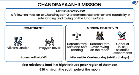
Researchers from ISRO (among others) created the first detailed lunar map using data from the Pragyan rover, which was deployed by Vikram (lander of India's Chandrayaan-3) on its nine-day mission.
- South Pole-Aitken Basin: Vikram landed near this ancient, massive impact crater (one of the largest in the Solar System).
Key Findings from Chandrayaan-3’s Lunar South Pole Exploration
- Terrain Types: Undulating landscape of highlands and low, flat plains.
- Confirmation of Subsurface Magma Ocean: Findings confirms ancient ocean of molten lava that extends across the entire moon.
- Age of the Lunar South Polar region: Calculated to be around 3.7 billion years, around the time the first signs of microbial life emerged on the earth.
- A Common Origin with Earth: The Moon’s geochemical similarities with Earth supports the theory that both bodies originated from the same molten material.
- Possibly due to a massive collision between Earth and a Mars-sized body about 4.5 billion years ago.
Significance of Lunar Craters
- The Moon’s craters have been preserved for billions of years due to no atmospheric erosion.
- They offer vital insights into the solar system’s early history and help date geological features on other planets.
- Lunar craters act as time capsules, preserving records of space-rock impacts shaping the entire solar system.


