
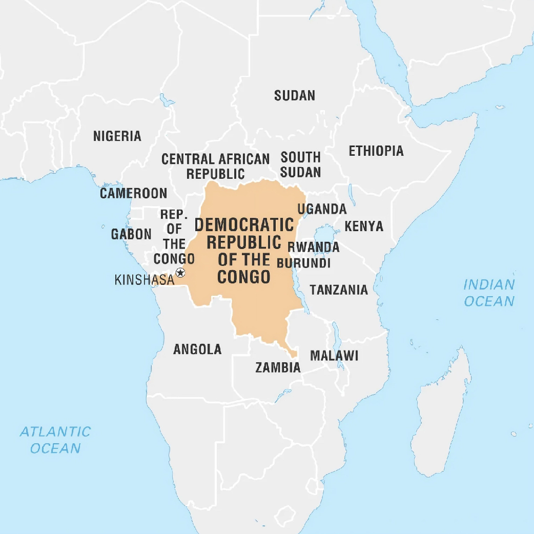
Democratic Republic of Congo (DRC) (Capital: Kinshasa)
Devastating floods occurred in the eastern part of DRC near the shores of Lake Tanganyika.
Political Features
- Located in Central Africa, it is the second largest country in Africa (after Algeria).
- Land Boundaries: Central African Republic (CAR), South Sudan (North); Uganda, Rwanda, Burundi, Tanzania (East); Republic of the Congo (RoC), Angola (West); Zambia (South).
- Maritime Boundary: Atlantic Ocean to its West.
Physical Features
- Climate: Tropical as Equator passes through DRC.
- Part of Congo Basin: Congo Basin forests span around 500 million acres and cover six countries: Cameroon, CAR, DRC, RoC, Equatorial Guinea, and Gabon.
- The Congo basin is home to the world's largest tropical peatlands, along with Brazil and Indonesia.
- Major River: Congo is the major river and it crosses the Equator twice.
- Major Minerals: Cobalt, gold, copper, coal, iron ore, lithium etc.
