
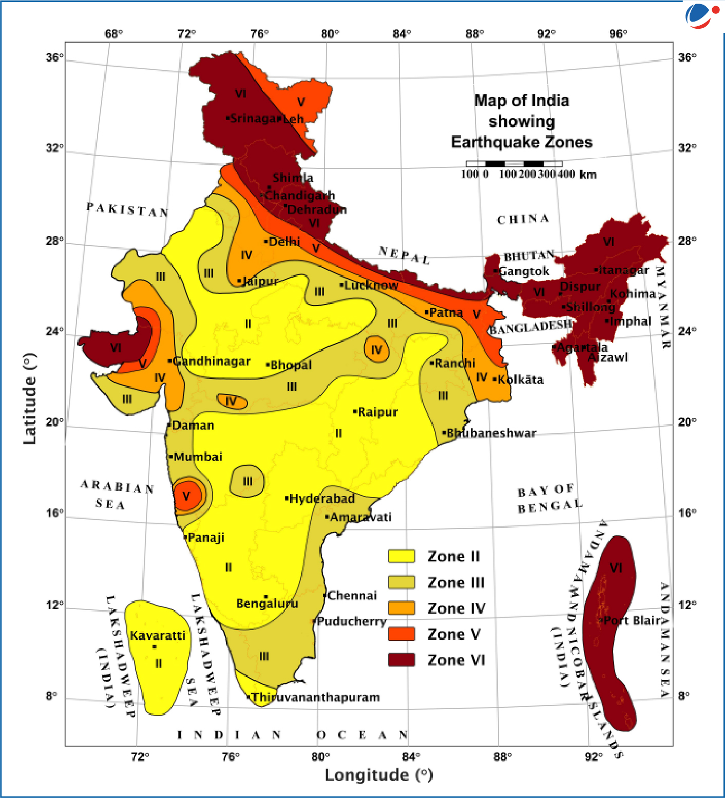
India has released a revised Seismic Zonation Map under the updated Earthquake Design Code (BIS, 2025) based on faults, maximum likely events, attenuation, tectonics, lithology, etc.
Details of New Zonation
- Number of Zones: Earlier, the Indian landmass was demarcated into four earthquake zones, namely Zones II, III, IV, and V.
- Introduces new highest-risk Zone VI, placing the entire Himalayan arc under it for the first time (previously split between Zones IV and V).
- Boundary towns between zones: Now automatically fall in the higher-risk category.
- Hazard mapping: Prioritises geological conditions over administrative boundaries.
India’s Earthquake Vulnerability:
- 61% of India’s land now lies in moderate to high hazard zones (earlier: 59%).
- 75% of India's population is now in seismically active regions.
- Implications of New Map: Nudges to retrofitting in high-risk regions, halting expansion on soft sediments or near active faults, enforcing uniform building standards in Himalayan states, etc.
- Government strategies:
- National Disaster Management Authority (NDMA) & State Disaster Management Authority (SDMA): NDMA is responsible for setting disaster management policies and SDMAs are in charge of creating and implementing disaster plans
- National Seismological Network: Monitors earthquake activities and conducts research on developing earthquake early warning systems.
