Last Updated: 16 Oct 2025

Digital Agriculture Mission (DAM)

The Digital Agriculture Mission aims to create a farmer-centric digital ecosystem for data-driven governance, transparency, and innovation in Agri-tech through public–private collaboration.

Quick Facts 

  • Purpose: Build a digital agriculture ecosystem with innovative solutions and timely, reliable crop and farmer information. 
  • Type: Central Sector Scheme except components of Support to states/ UTs (Centrally Sponsored) 
  • Intended beneficiary: Farmers 
  • Tenure: 5 Years (FY 2021-22 to FY 2025-26)

Objective 

  • Build a farmer-focused digital ecosystem to enhance transparency in the government programs. 
  • Aid government in informed decision-making.
  • To promote public and private innovation and partnerships in Agri-tech.
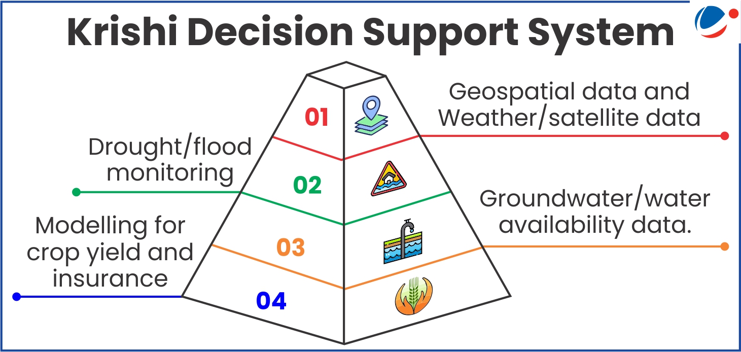
Salient Features

Background:

Infographic outlining AgriStack's three pillars for digital transformation of farmer identity: geo-referenced village maps for spatial data, farmers' registry providing unique digital IDs linked to land records, and crop sown registry enabling real-time agricultural tracking.
  • The National e-Governance Plan in Agriculture (NeGPA) began in 2010-11 to provide timely agricultural information using ICT and updated in 2020-21 to adopt digital technologies. 
  • The DAM now supports initiatives like Digital Public Infrastructure, Crop Estimation, and IT projects by governments and institutions.

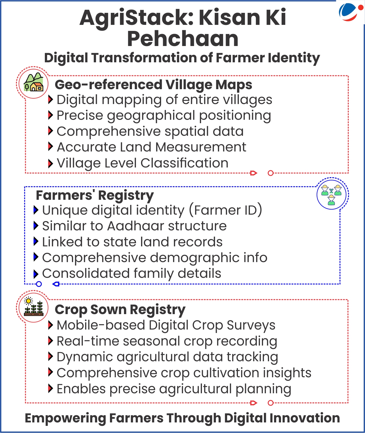
Programmes and schemes under DAM:

  • Agristack: A digital publicgood like "Aadhar" for efficient farmerservices. Built with Central, State,and UT collaboration in a federated system. Includes three key agriculture registries/databases (refer to the infographic).
  • Krishi Decision Support System:
    • Integrates geospatial and non-geospatial data for satellite, weather, soil, crops, and government schemes.
    • Supports crop mapping, diversification, and insurance claims, aligned with the National Geo-Spatial Policy.
  • Nationwide Soil Resource Mapping project: 
    • Initiate by Soil and Land Use Survey of India (SLUSI), it uses high-resolution satellite and ground data to map village- level soils at a 1:10,000 scale.
    • Creates detailed soil profiles and standardized maps for sustainable agriculture and better land and crop planning.
Pyramid diagram illustrating the Krishi Decision Support System's four-layer data architecture: geospatial and weather/satellite data at top, drought/flood monitoring, groundwater availability data, and crop yield modeling for insurance at the base.
  • Digital General Crop Estimation Survey (DGCES): To Automate the General Crop Estimation Survey (GCES) process, from state-level  planning to field data recording of Crop Cutting Experiments and report generation.
  • IT Initiatives Support: Includes IT Initiative support to Statesand Other Organizations under the Mission, Support for IT-related activities of DA&FW.
  • Support to Mahalanobis National Crop Forecasting Centre (MNCFC): Estimates crop acreage and production under             FASAL  and       assesses horticulture crops.
    • Aids drought monitoring, weather tracking, and geospatial training for states.
    • Technical partner for PMFBY, assisting in area analysis, smart sampling, and yield dispute resolution.
Subscribe for Premium Features

Quick Start

Use our Quick Start guide to learn about everything this platform can do for you.
Get Started