
Why in the News?
Indian Regional Navigation Satellite System (IRNSS)-Navigation with Indian Constellation (NavIC) has suffered a major setback after the last atomic clock on board the IRNSS-1F stopped functioning.
More on the news
- This leaves only 3 satellites (IRNSS-1B, 1I, and NVS-01) of the NavIC constellation capable of providing PNT (Position, Navigation, and Timing) services.
- Total of 6 of 11 Indian satellites meant for the NavIC system have failed due to the atomic clocks.
- At least 4 satellites with operational atomic clocks are required for the navigation satellite system to function properly.
About IRNSS – Navigation with Indian Constellation (NavIC)
- It is an independent regional navigation satellite system developed by Indian Space Research Organisation (ISRO).
- Coverage: To provide accurate Position, Velocity and Timing (PVT) service to users in India as well as to region extending about 1500 km beyond Indian land mass.
- Key services:
- Standard Positioning Service (SPS): Available for all civilian users and uses L5 and S band.
- It provides position accuracy of better than 20 meters and timing accuracy better than 40 nanoseconds over the service area.
- Restricted Service (RS): Encrypted service for authorized users and uses L5 band.
- Standard Positioning Service (SPS): Available for all civilian users and uses L5 and S band.
- Satellite Constellations:
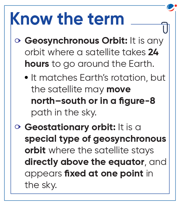
- First Generation: Consists of 7 satellites- 3 satellites in Geostationary orbit (GEO) and 4 in Geosynchronous orbit originally and a network of ground stations operating 24 x 7.
- IRNSS-1A was India's first dedicated navigational satellite launched in 2013.
- IRNSS 1-F was launched by PSLV-C32 into a sub–Geosynchronous Transfer Orbit (GTO) in 2016.
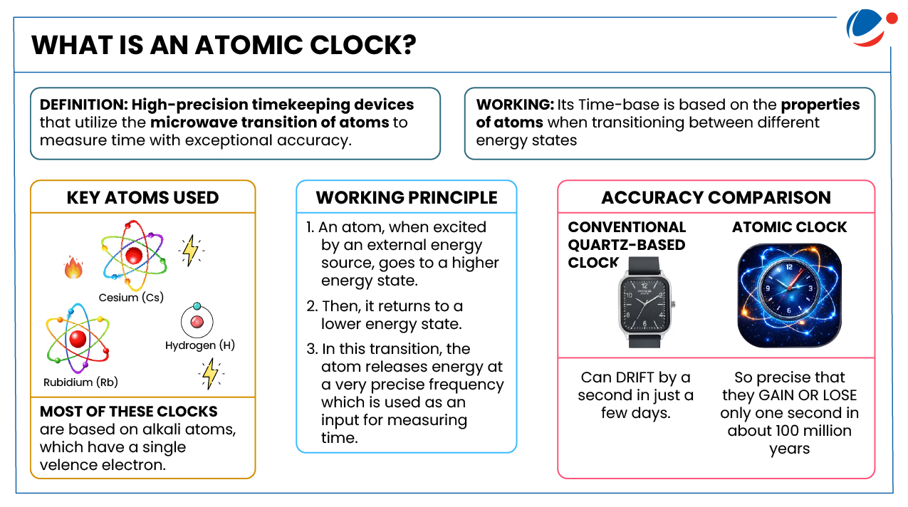
- It was the 6th navigation satellite and carried an imported Swiss-made rubidium atomic clock.
- Second-generation: NVS (Navigation Satellite) series of satellites which incorporates L1 band signals additionally to widen the services.
- Five second-generation NavIC satellites viz., NVS-01/02/03/04/05 are envisaged to augment NavIC base layer constellation with enhanced features for ensuring continuity of services.
- NVS-01: Launched onboard GSLV-F12 in 2023 and carried an indigenous atomic clock for the first time.
- Five second-generation NavIC satellites viz., NVS-01/02/03/04/05 are envisaged to augment NavIC base layer constellation with enhanced features for ensuring continuity of services.
- First Generation: Consists of 7 satellites- 3 satellites in Geostationary orbit (GEO) and 4 in Geosynchronous orbit originally and a network of ground stations operating 24 x 7.
- NVS-02: Launched onboard GSLV-F15 in 2025, but failed to reach its designated orbit, it was configured with Navigation payload in L1, L5 and S bands in addition to ranging payload in C-band like NVS-01.
Significance of functional IRNSS-NaVIC
- Strategic Independence: A non-functional NavIC forces India back onto total reliance on the US-owned GPS with potential of denial in conflicts.
- E.g., In 1999 Kargil War, USA denied use of GPS.
- National Security: IRNSS provides encrypted Restricted Service (RS) for armed forces, supports missile guidance, surveillance, and real-time troop movement.
- Infrastructure support: E.g., around 8700 trains are equipped with NavIC along with other GNSS constellations; Integration with GAGAN for aviation etc.
- Global Interoperability: SPS signals are interoperable with the other global navigation satellite system (GNSS) signals namely GPS (USA), Glonass (Russia), Galileo (Europe) and BeiDou (China).
- Other support: Disaster Management; Transportation (terrestrial, aerial and marine); location-based services, personal mobility; Surveying and geodesy; scientific research; time dissemination and synchronization etc.
Challenges related to NaVIC
- Poor Launch Rate: The constellation is deteriorating faster than can be replenished, owing to ISRO's limited launch rate, constrained by budget pressures required to sustain a PNT system.
- Organizational Overextension: The absence of a national space law forces ISRO to act as both the designer and operator of NavIC, which overextends the agency's resources.
- Lack of management body: India lacks a counterpart to the GPS Directorate and European Union Agency for the Space Programme (EUSPA), which respectively manage the GPS and Galileo constellations.
- Incompatibility: Not all smartphones and navigational gadgets (or navigators) are compatible with NavIC.
Conclusion
Department of Space is expanding NavIC's use across key sectors such as real-time train tracking, fishing vessel communication, vehicle tracking for passenger safety, and dissemination of Indian Standard Time (IST). It is also focused on fully perationalizing NavIC for secure navigation by completing the base constellation, enhancing services based on user needs, and integrating indigenous technologies like space-grade atomic clocks to strengthen technological self-reliance.
