
Why in the News?
A study highlighted the inadequate risk assessment of the growing number, size, and volume of glacial lakes across the Himalaya-Karakoram ranges, despite increased risks of Glacial Lake Outburst Floods (GLOFs).
Key highlights of the study (by IIT Roorkee)
- > 31,000 of glacial lakes are growing across High Mountain Asia (HMA).
- Highest area coverage of glacial lakes observed in Eastern Himalaya region.
- Glacial lakes in HMA experienced a total area increase of 5.5%.
About Glacial Lake and Glacial Lake Outburst floods (GLOFs)
- A Glacial lake is a body of water formed by the melting of glacial ice, typically created in depressions or basins carved out by glaciers during their movement.
- There are 4 categories of glacial lakes (based on their formation process) i.e. Moraine-dammed, Ice-dammed, Erosion, and others.
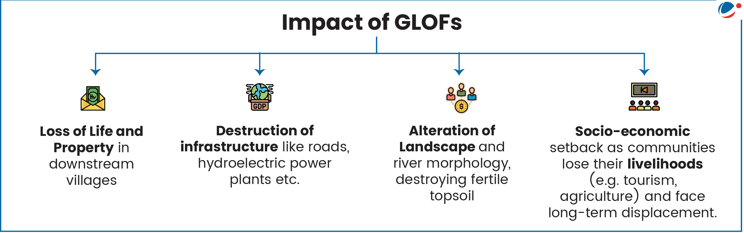
- Glacial Lake Outburst Flood is the sudden release of water from a lake fed by glacier melt that has formed at the side, in front, within, beneath, or on the surface of a glacier.
- Examples of GLOFs
- 2023: GLOF at South Lhonak, destroyed the Teesta III Dam at Chungthang in Sikkim.
- 2013: GLOF in Chorabari glacial lake and floods in Mandakini river in Uttarakhand.
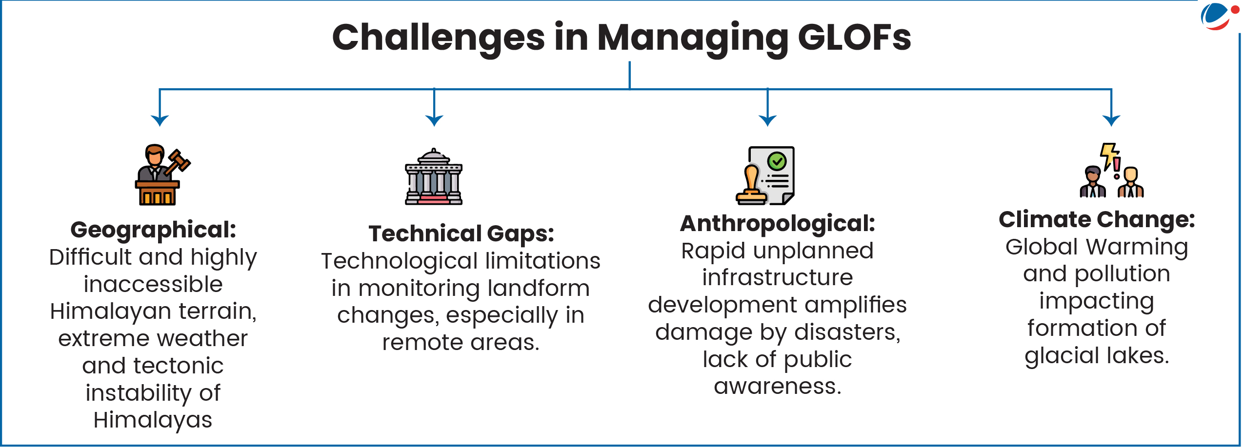
Major Causes of GLOFs
- Rising global temperatures: It accelerated glacier melting and retreat, driving the formation and expansion of glacial lake beyond their capacity.
- Globally, since 1990, the number, area, and volume of glacial lakes have risen by 53%, 51%, and 48%, respectively.
- Glacial Surging: Sudden movement of ice over a relatively short period of time resulting in severe rapid glacier advance. E.g., Gilkey Glacier, Alaska.
- Structural Failure: Unstable moraines (loose debris and ice) can breach due to internal erosion, hydrostatic pressure or thawing permafrost.
- E.g. South Lhonak GLOF, Sikkim.
- Mass Movement: Avalanches or landslides crashing into the lake create "displacement waves" that can trigger the dam breach.
- E.g. 2021 Chamoli GLOF due to rock and ice avalanche.
- Cascading Events: Earthquakes (common in the Hindu Kush-Himalaya region) can trigger immediate dam collapses.
- Human Activity: Activities such as unregulated urbanization, irrational mining, deforestation, hydropower projects, GHG emissions etc. can alter drainage patterns and stability of slope.
Mitigation Strategies for GLOFs
In India
- National Glacial Lake Outburst Flood (GLOF) Risk Mitigation Project (NGRMP): Aimed at GLOF risk reduction in 4 states namely, Arunachal Pradesh, Himachal Pradesh, Sikkim and Uttarakhand.
- Hazard Mapping: Using ISRO satellite data to create detailed vulnerability maps of the Himalayan belt.
- Central Water Commission (CWC) monitors 900+ glacial lakes and finalized the criteria for Risk Indexing of Glacial Lakes.
- IIT Guwahati researchers developed a method to predict glacial lake formation in the Himalayas, identifying 493 high-risk sites in the Eastern Himalayas.
- Early Warning Systems (EWS): Installing sensors that detect sudden water level changes and trigger sirens in downstream villages.
- E.g. 2 Automatic Weather Stations (AWS) installed in Sikkim for EWS.
- Structural Engineering: Reducing water levels by siphoning or pumping water out, and creating artificial spillways to control discharge.
Global Initiatives
- Transboundary Cooperation: Cross-border glacial lakes (e.g., China, Nepal, India) require data sharing for early warnings.
- E.g. Sendai Framework for Disaster Risk Reduction encourages international cooperation to manage cross-border GLOF risks.
- HKH cryosphere initiative: by International Centre for Integrated Mountain Development (ICIMOD) to monitor glacial lakes.
- Community-Based Disaster Risk Reduction (CBDRR): Training local "first responders" to recognize early signs of dam instability. E.g. In the Andes and Alps, Bhutan etc.
Way forward: National Disaster Management Authority (NDMA) Guidelines for Management of GLOFs, 2020
- Identify, Map, and Prioritize Vulnerable Lakes: Using Remote Sensing (RS) and Geographic Information Systems (GIS) to classify them based on susceptibility.
- Develop and Deploy Early Warning Systems (EWS): Utilizing ground instrumentation, Automatic Water Level Recorders (AWLR), and seismicity monitoring at critical lakes.
- Formulate and Enforce Land-Use Zoning Regulations: Constitute a specialized committee to formulate specific land-use zoning, development controls, and building construction regulations tailored to GLOF/LLOF hazard areas.
- Execute Structural Risk Reduction Measures: Through structural engineering interventions such as controlled breaching, siphoning or pumping out water, excavating open drainage channels.
Conclusion
It is vital to develop comprehensive understanding of the causes, triggers and processes of GLOFs using scientific research and create a robust institutional and community response mechanism towards disaster preparedness and mitigation to ensure that the impact of GLOFs is minimized.


